Better photos through auto-optimization.
Supports on land, underwater and cross-borehole surveys.
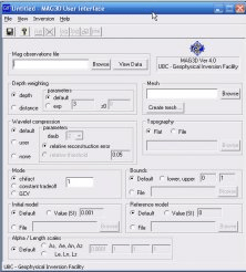
Is a program for carrying out forward modelling and smooth inversion of surface
Contains radar images of geological formations around the world
Updates Pioneer cycle computers and uploades log data automatically.